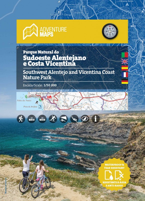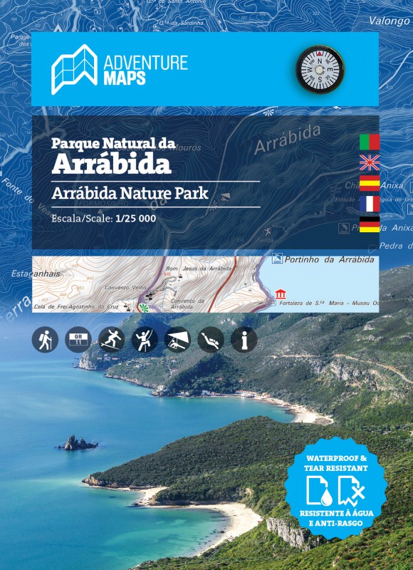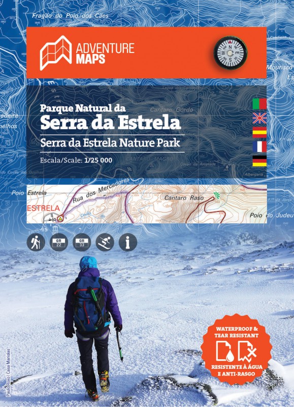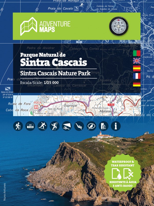

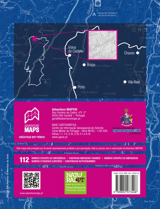

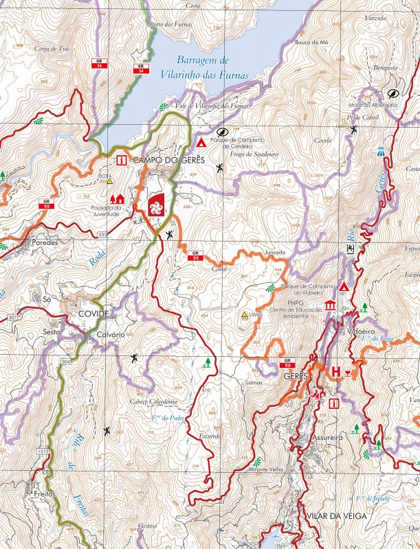


TECHNICAL CHARACTERISTICS:
· Cartographic base CIGeoE - Geospatial Information Center of the Army
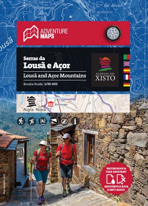
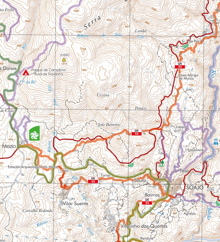
· Scale: 1/50 000 (1 cm = 500 m)
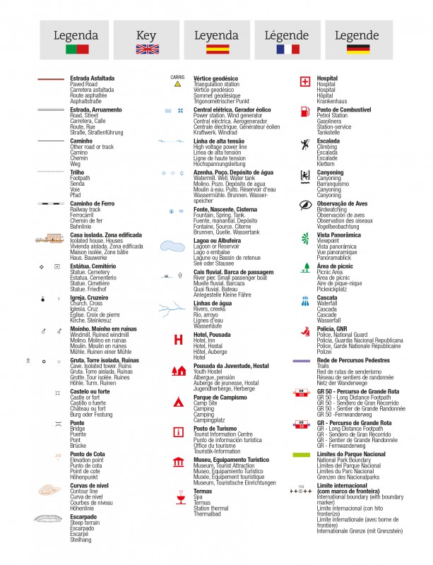
· Legend and Additional Information in Portuguese, English, Spanish, French and German
· Built-in magnetic compass
· Paths, GR(Long Distance Path) and PR(Short Distance Path), includes GR34 and GR50
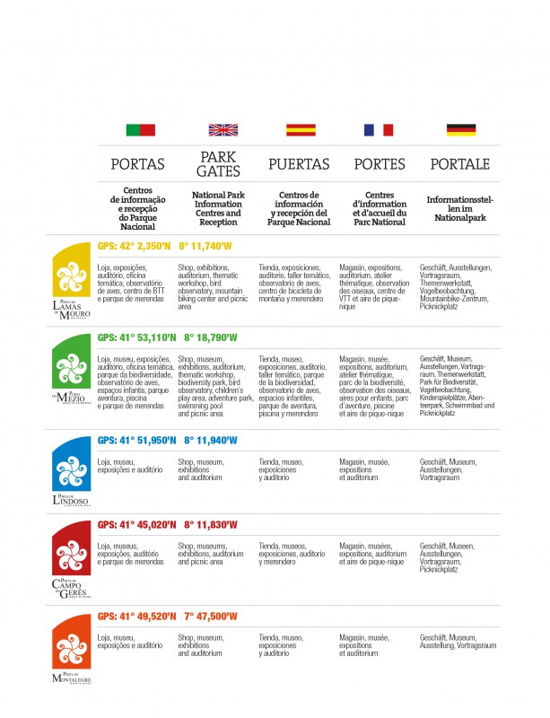
· Specific information of the "Ports" as information and reception centers of the National Park
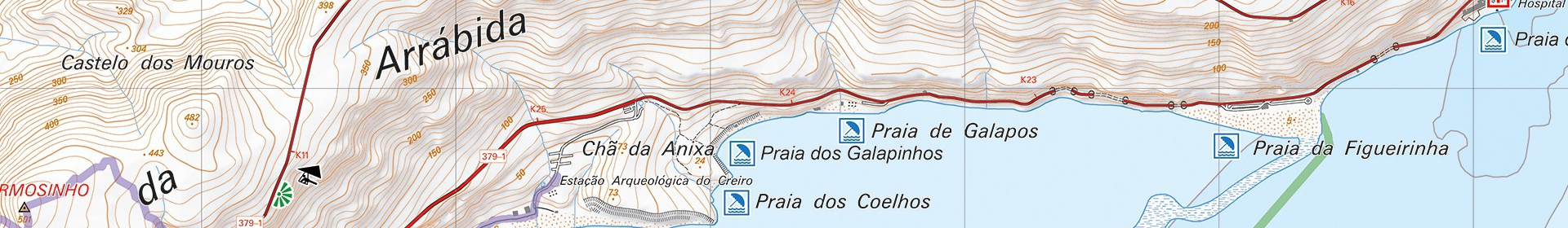
· Tourist points of interest with symbols, Waterfalls, Panoramic Views, Picnic Areas, Museums and Tourism Stations, among others
· Climbing, Canyonig and Bird Watching Spots
· Equidistance of contour lines: 20 m
· UTM Quadricula with divisions of 2 Km(compatible with GPS)
· WGS84 coordinates (compatible with GPS)
· Representation of the magnetic declination
· Open size: 96cm x 59cm
· Folded Size: 15.5cm x 19.7cm
· Printing: double-sided with overlapping area
Synthetic Paper waterproof and anti tear
"Peneda-Gerês National Park occupies an area of 69,594.48 ha and extends from Mourela to Castro Laboreiro plateaus. This area also includes the mountains of Peneda, Soajo, Amarela and Gerês. This is a mountainous region, composed mainly of granite, with points of high altitude where the effects of the latest glaciation can be seen. Deep and embedded valleys support a dense hydrographic network.
PNPG has a remarkable botanical diversity - woods, forests, riparian vegetation and peatlands in addition to wet meadows - with special importance to the varied rare and endemic species. PNPG is home to some of the most important oak forests in Portugal as well as interesting semi-natural habitats, a diversity of animal species (235 vertebrates) with varying status including endemic (gold-striped salamander), endangered (Iberian wolf, Iberian wild goat) and with limited distribution species (whinchat). In the agricultural areas the prairies and "prados de lima" (seminatural humid meadows) stand out.
Peneda-Gerês National Park, the only national park in Portugal, is also rich historical and cultural heritage (megalithic necropolis, traces of romanization, castles, traditional granaries with corncobs, ovens, mills, dams, terraces, etc.) and visitors can learn more about it exploring the mountain villages and seeing the presence of well-preserved traditional architecture sets."
Text: INSTITUTO DA CONSERVAÇÃO DA NATUREZA E DAS FLORESTAS, I.P.
Mapas,mapa peneda gerês, caminhadas no gerês,percursos pedestres, cascatas do geres